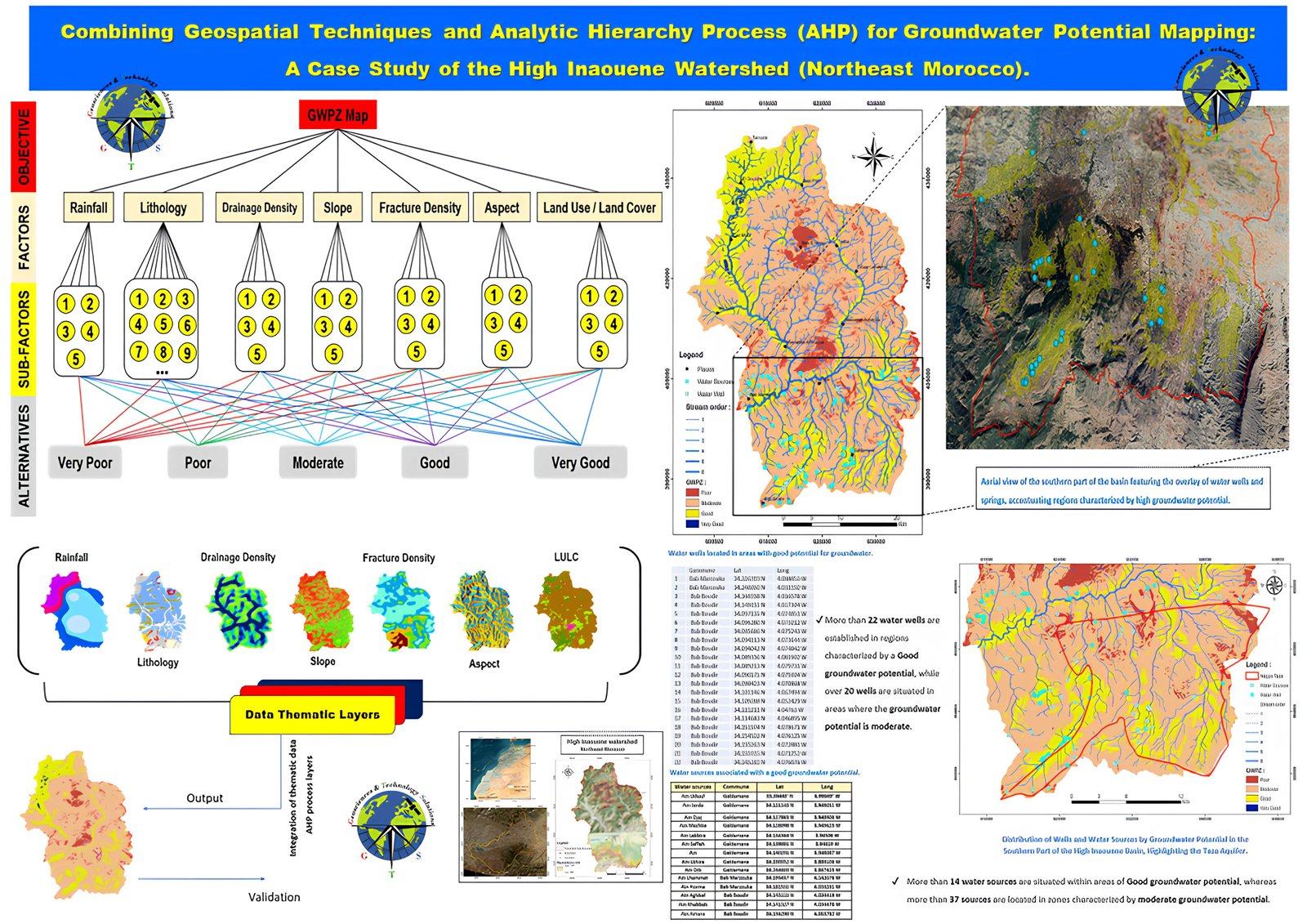
Module 1: Unveiling the World of Google Earth Engine
Introduction to Google Earth Engine
- Creating a Google Earth Engine Account
- Exploration of the Data Catalog
****************************************************
Module 2: Foundational Spells - Basic Data Loading Incantations
- Importing Vector Data
- Importing Raster Data
******************************************************
Module 3: Epic Enchantments - Mastering Advanced Data Loading Techniques
Delving into the wizardry of raster data import.
- Understanding Image Collections
Grasping the concept of image collections.
Techniques for managing and manipulating image collections.
- Summoning Sentinel-2 Imagery /landsat
- Export data
- cliping
************************************************
Module 4: Legendary Efficiency - Optimizing Your Earth Engine Powers
- Mastering Filtering and Masking
- Unveiling Best Practices
- The secrets of efficient data loading.
- Pitfalls to avoid for a seamless workflow.
******************************************************
Module 5: Realms of Application - Showcasing Your Heroic Data Feats
*************************************************************
Module 6: Conquering the Land Cover and Land Use Challenge
- Introduction to the Challenge
- Present the final project challenge: Analyzing and mapping land cover and land use changes in a specific region over time.
- Emphasize the real-world impact and applications of this analysis.
Defining Project Objectives
Clearly outline the objectives of the land cover and land use project.
Specify the expected outcomes and deliverables.
Project Execution:
- Data Acquisition and Preparation
- Guide participants in selecting relevant datasets from the Earth Engine Data Catalog for their chosen region.
- Demonstrate the process of loading and preparing the data for analysis.
Temporal Analysis and Change Detection
Instruct participants on how to perform temporal analysis to observe changes over multiple years.
Implement change detection techniques to identify areas with significant land cover changes.
Land Cover Classification
- Creating Maps and Visualizations and exporting
- Guide participants in creating informative maps and visualizations to communicate their findings effectively.
- Encourage the use of Earth Engine's visualization capabilities.
- Interpreting Results and Drawing Conclusions